

Have you ever wondered which state is the most western in geographical positioning? Depending on how you define each state’s boundaries and how you measure its center, the answers can vary drastically.
If we use the mean longitude of each state, which I am defining as the meridian that is equidistant from the state’s easternmost and westernmost points, we can rank the states from easternmost to westernmost by mean longitude.
The States by Mean Longitude
- Maine (69.0ºW)
- Rhode Island (71.5ºW)
- New Hampshire (71.6ºW)
- Massachusetts (71.7ºW)
- Vermont (72.4ºW)
- Connecticut (72.8ºW)
- New Jersey (74.7ºW)
- Delaware (75.4ºW)
- New York (75.8ºW)
- Maryland (77.3ºW)
- Pennsylvania (77.6ºW)
- Virginia (79.5ºW)
- North Carolina (79.9ºW)
- West Virginia (80.2ºW)
- South Carolina (80.9ºW)
- Ohio (82.5ºW)
- Georgia (83.2ºW)
- Florida (83.8ºW)
- Kentucky (85.8ºW)
- Tennessee (86.0ºW)
- Michigan (86.4ºW)
- Indiana (86.4ºW)
- Alabama (86.7ºW)
- Illinois (89.5ºW)
- Wisconsin (89.8ºW)
- Mississippi (89.9ºW)
- Louisiana (91.4ºW)
- Arkansas (92.1ºW)
- Missouri (92.4ºW)
- Minnesota (93.4ºW)
- Iowa (93.4ºW)
- Kansas (98.3ºW)
- Oklahoma (98.7ºW)
- Nebraska (99.7ºW)
- Texas (100.1ºW)
- South Dakota (100.2ºW)
- North Dakota (100.3ºW)
- Colorado (105.6ºW)
- New Mexico (106.0ºW)
- Wyoming (107.6ºW)
- Montana (110.0ºW)
- Utah (111.5ºW)
- Arizona (111.9ºW)
- Idaho (114.1ºW)
- Nevada (117.0ºW)
- California (119.3ºW)
- Oregon (120.5ºW)
- Washington (120.8ºW)
- Alaska (158.8ºW)
- Hawaii (166.6ºW)
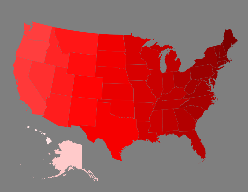
There we have it, it appears that, based on mean longitude, Hawaii is the most western state!
Hold on, why does the mean longitude of Hawaii appear to be west of the entirety of Hawaii? How can this be the middle of Hawaii if it is outside of the state? This is because the 8 largest islands in Hawaii that we usually recognized as the state of Hawaii are only the southeastern portion of the Hawaiian Islands. In reality, the state of Hawaii officially recognizes 137 islands, stretching a little further west than Midway Atoll; this makes Hawaii over 1,500 miles long. If you don’t count any Hawaiian Islands besides the 8 main islands, then Alaska is the furthest west state, but for this post, I am considering all 137 islands.
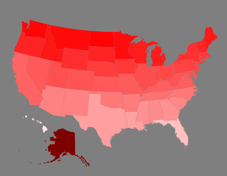
Now let’s rank the states from northernmost to southernmost.
The States by Mean Latitude
- Alaska (61.3ºN)
- North Dakota (47.5ºN)
- Washington (47.3ºN)
- Montana (46.7ºN)
- Minnesota (46.4ºN)
- Idaho (45.5ºN)
- Maine (45.2ºN)
- Michigan (45.0ºN)
- Wisconsin (44.8ºN)
- South Dakota (44.2ºN)
- Oregon (44.1ºN)
- New Hampshire (44.0ºN)
- Vermont (43.9ºN)
- Wyoming (43.0ºN)
- New York (42.8ºN)
- Massachusetts (42.1ºN)
- Iowa (41.9ºN)
- Rhode Island (41.6ºN)
- Connecticut (41.5ºN)
- Nebraska (41.5ºN)
- Pennsylvania (41.0ºN)
- Ohio (40.2ºN)
- New Jersey (40.1ºN)
- Indiana (39.8ºN)
- Illinois (39.7ºN)
- Utah (39.5ºN)
- Delaware (39.1ºN)
- Colorado (39.0ºN)
- West Virginia (38.9ºN)
- Maryland (38.8ºN)
- Nevada (38.5ºN)
- Kansas (38.5ºN)
- Missouri (38.3ºN)
- Virginia (38.0ºN)
- Kentucky (37.8ºN)
- California (37.3ºN)
- Tennessee (35.8ºN)
- Oklahoma (35.3ºN)
- North Carolina (35.2ºN)
- Arkansas (34.8ºN)
- Arizona (34.2ºN)
- New Mexico (34.2ºN)
- South Carolina (33.6ºN)
- Alabama (33.0ºN)
- Georgia (32.7ºN)
- Mississippi (32.6ºN)
- Texas (31.2ºN)
- Louisiana (31.0ºN)
- Florida (27.8ºN)
- Hawaii (23.7ºN)
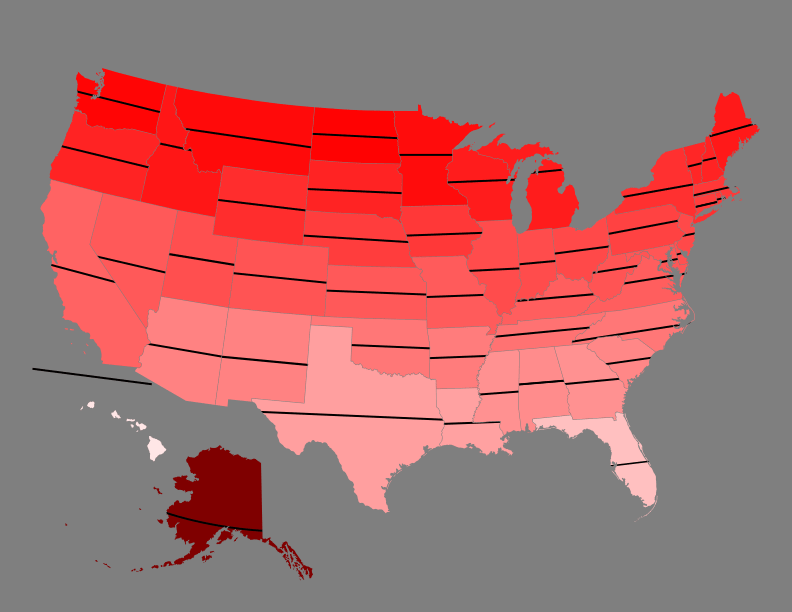
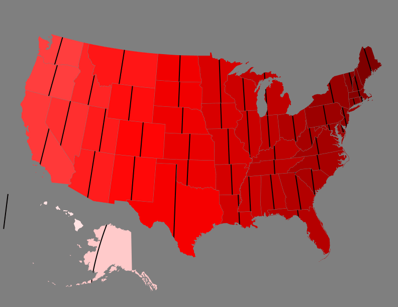
What about the centers of the states? I can simply combine the mean latitude and longitude of each state, which will give me the center point of each state. You can define the center of each state by a few different rules, but these centers are exactly equidistant from the northernmost, southernmost, easternmost, and westernmost points of each state. I have also included the city name of the zip code in which the point lies, if one exists in the area.
The Center Points of the States
| State | City | Coordinates |
|---|---|---|
| Alabama | Jemison | 32.981ºN, 86.681ºW |
| Alaska | Bethel Census Area | 61.298ºN, 158.776ºW |
| Arizona | Black Canyon City | 34.168ºN, 111.931ºW |
| Arkansas | North Little Rock | 34.752ºN, 92.132ºW |
| California | Big Creek | 37.272ºN, 119.273ºW |
| Colorado | Lake George | 38.998ºN, 105.551ºW |
| Connecticut | Meriden | 41.516ºN, 72.758ºW |
| Delaware | Dover | 39.145ºN, 75.419ºW |
| Florida | Gulf of Mexico, 60 miles from Indian Shores | 27.761ºN, 83.833ºW |
| Georgia | Danville | 32.679ºN, 83.223ºW |
| Hawaii | Pacific Ocean, 23 miles from Tern Island | 23.683ºN, 166.591ºW |
| Idaho | North Fork | 45.494ºN, 114.143ºW |
| Illinois | Rochester | 39.740ºN, 89.505ºW |
| Indiana | Avon | 39.766ºN, 86.442ºW |
| Iowa | Maxwell | 41.938ºN, 93.391ºW |
| Kansas | Geneseo | 38.498ºN, 98.320ºW |
| Kentucky | Lebanon Junction | 37.823ºN, 85.768ºW |
| Louisiana | Saint Francisville | 30.974ºN, 91.430ºW |
| Maine | Milo | 45.217ºN, 69.015ºW |
| Maryland | Fairfax, Virginia, 11 miles from Glen Echo, Maryland | 38.819ºN, 77.268ºW |
| Massachusetts | Douglas | 42.063ºN, 71.719ºW |
| Michigan | Lake Michigan, 13 miles from Glen Arbor | 44.979ºN, 86.418ºW |
| Minnesota | Aitkin | 46.442ºN, 93.366ºW |
| Mississippi | Canton | 32.585ºN, 89.877ºW |
| Missouri | Eugene | 38.305ºN, 92.437ºW |
| Montana | Harlowton | 46.680ºN, 110.044ºW |
| Nebraska | Merna | 41.501ºN, 99.681ºW |
| Nevada | Manhattan | 38.502ºN, 117.023ºW |
| New Hampshire | Lincoln | 44.001ºN, 71.580ºW |
| New Jersey | Delaware River, 0.15 miles from Bordentown | 40.143ºN, 74.731ºW |
| New Mexico | Mountainair | 34.166ºN, 106.026ºW |
| New York | Georgetown | 42.756ºN, 75.809ºW |
| North Carolina | Mount Gilead | 35.216ºN, 79.891ºW |
| North Dakota | Denhoff | 47.468ºN, 100.302ºW |
| Ohio | Utica | 40.189ºN, 82.519ºW |
| Oklahoma | Corn | 35.309ºN, 98.717ºW |
| Oregon | Prineville | 44.146ºN, 120.538ºW |
| Pennsylvania | Howard | 40.995ºN, 77.604ºW |
| Rhode Island | North Kingstown | 41.583ºN, 71.507ºW |
| South Carolina | Orangeburg | 33.626ºN, 80.947ºW |
| South Dakota | Fort Pierre | 44.213ºN, 100.247ºW |
| Tennessee | Woodbury | 35.831ºN, 85.979ºW |
| Texas | Eden | 31.169ºN, 100.077ºW |
| Utah | Moroni | 39.500ºN, 111.548ºW |
| Vermont | Tunbridge | 43.872ºN, 72.445ºW |
| Virginia | Goshen | 38.003ºN, 79.459ºW |
| Washington | Cle Elum | 47.273ºN, 120.844ºW |
| West Virginia | Buckhannon | 38.920ºN, 80.182ºW |
| Wisconsin | Mosinee | 44.786ºN, 89.827ºW |
| Wyoming | Shoshoni | 43.000ºN, 107.553ºW |
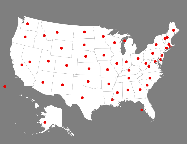
You may notice that, based on my definition of center, the center points of the states of Florida, Hawaii, Michigan, and New Jersey all land in water, however, the strangest center point is quite possibly Maryland’s, which lands in Virginia; this is because the Maryland-Virginia border follows the Potomac River, which curves just north of the point that is equidistant from Maryland’s extreme points, but because Maryland is located on the north side of the river and Virginia is on the south, the center point of Maryland is technically within Virginia’s domain.
Which center point is your favorite?
