

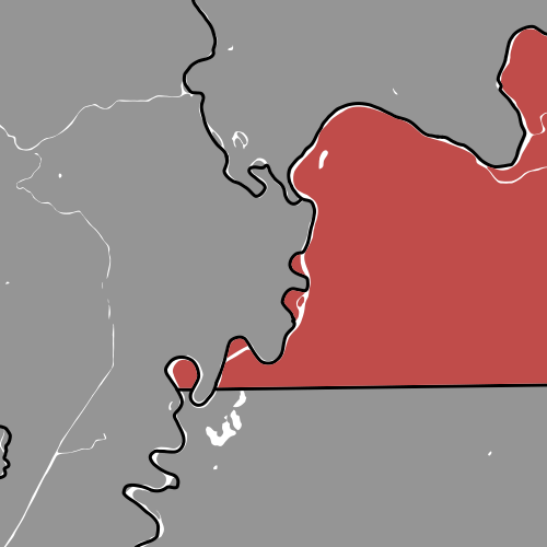
When I was looking on a map at the Mississippi River and the way it meanders across the nation, I noticed that one state in particular had quite an odd corner which earned it a seat in this series; Kentucky. I discovered that this peninsula of Kentucky that is unconnected from the rest of the state is commonly called the “Kentucky Bend,” along with a variety of other names, including “Bubbleland.”
This Kentuckian Peninsula is wrapped on all side but one by the Mississippi River, and its only land connection is to Tennessee; the only road leading into the Kentucky Bend is one Tennessean highway. On this peninsula you will find several fields, a few homes, a cemetery, and little more than a dozen residents, but zero towns!
How was the Kentucky Bend formed?
There are several opinions about why the Kentucky Bend was added to Kentucky and not Tennessee, but this debate appears to have been started early in colonial America, before Kentucky separated from Virginia and before Tennessee separated from North Carolina. You can check out my posts about Kentucky’s separation and Tennessee’s separation!
Apparently Kentucky and Tennessee had a long standing dispute over the Kentucky Bend, each side claiming to own it, but at this point in time, there isn’t a lot of information about the history of this land online.
My best assumption is that the bend was added to Kentucky because it is on the east side of the Mississippi River and north of the parallel 36º30’N (approximately the Kentucky-Tennessee border).
If the bend was completely south of that line of latitude, it would probably be a part of Tennessee and there would be no dispute. This interesting piece of land only exists likely because of the way the river runs and because of the definition of Kentucky and Tennessee’s borders.
If you know more about the Kentucky Bend, feel free to share in the comments.
